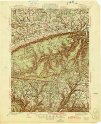
1945 Map of Powell
USGS Topo · Published 1945About this map
Towanda Creek and its many tributaries carve through the mountainous terrain of Bradford and Sullivan Counties, documenting a landscape defined by isolated settlements and early industrial infrastructure. The defunct Susquehanna and New York RR follows the narrow valley of Schrader Creek, passing the remote stations and mountain hamlets of Barclay, Carbon, and Barclay Station. These upland areas, once hubs for coal and lumber, are interspersed with family-named features like Hoagland and Quinlantown.
Find a feature on this map
73 named features on this map. Tap any name to fly to it.
Don’t see what you’re looking for? This feature index may not catch every label — zoom into the map to look around manually.
Map Details
Editions of this 1945 Powell Map
3 editions found

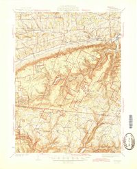
Other maps of this area

1923 · Towanda
USGS Topo · 1:62,500

1926 · Towanda
USGS Topo · 1:62,500

1927 · Eagles Mere
USGS Topo · 1:48,000

1930 · Warrensville
USGS Topo · 1:62,500

1931 · Troy
USGS Topo · 1:48,000

1932 · Eagle Mere
USGS Topo · 1:62,500

1934 · Warrensville
USGS Topo · 1:62,500

1934 · Laporte
USGS Topo · 1:62,500

1938 · Troy
USGS Topo · 1:62,500

1939 · Sayre
USGS Topo · 1:62,500
Featured Places
- West Burlington Township, PA
- Leroy Township, PA
- Overton Township, PA
- Long Valley, Franklin Township
- Weston, Monroe Township