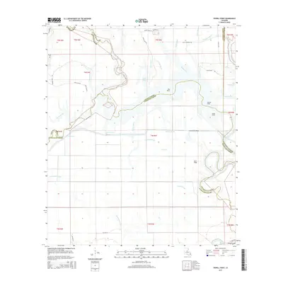
2015 Map of Powell Point
USGS Topo · Published 2015About this map
Big Saline Bayou meanders through a landscape defined by complex hydrology and shifting parish boundaries in this 2015 survey. The map details the convergence of Rapides, LaSalle, and Avoyelles Parishes, illustrating how water bodies like Camels Slough and Raccoon Bayou dictate the geography of the region. Notable topographic features such as Counterfeit Ridge and Gum Ridge provide subtle elevation among the numerous waterways. Local history is anchored by the Deville Cem in the northwest, while family-named routes such as Raymond Price Rd and Steve's Lake Rd reflect the enduring local connection to the land. The southern reaches are marked by the presence of the Old Red River, emphasizing the historical importance of fluvial movement in shaping this corner of Louisiana.
Find a feature on this map
52 named features on this map. Tap any name to fly to it.
Don’t see what you’re looking for? This feature index may not catch every label — zoom into the map to look around manually.
Map Details
Editions of this 2015 Powell Point Map
This is the sole edition of this map. No revisions or reprints were ever made.
Other maps of this area

1935 · Tooleys
USGS Topo · 1:62,500

1940 · Marksville
USGS Topo · 1:62,500

1941 · Voorhies
USGS Topo · 1:62,500

1941 · Buckeye
USGS Topo · 1:62,500

1941 · Tooleys
USGS Topo · 1:62,500

1953 · Alexandria
USGS Topo · 1:250,000

1953 · Natchez
USGS Topo · 1:250,000

1955 · Alexandria
USGS Topo · 1:250,000

1956 · Natchez
USGS Topo · 1:250,000

1959 · Natchez
USGS Topo · 1:250,000