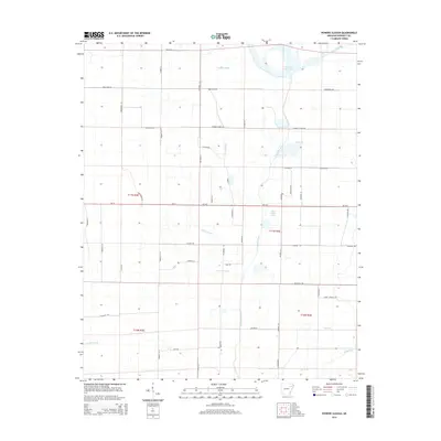
2014 Map of Powers Slough
USGS Topo · Published 2014About this map
Powers Slough dominates the central lowlands of this Poinsett County landscape, where the L'Anguille River meanders south through a network of drainage channels and small tributaries. The terrain is defined by a heavy reliance on water management and agricultural infrastructure, evidenced by the presence of Claypool Reservoir in the northeast and John Kocher Lake further south. Numerous named bayous and branches, such as Raccoon Bayou, Mardis Br, and Hollow Br, slice through the township grids, illustrating the complex hydrology of the Arkansas Delta. A systematic grid of section roads and lanes, including Weiner Cutoff Rd and family-named routes like Massengill Rd and Huber Ln, provides access to the surrounding fields. The map captures the agricultural character of the region during a period of modern surveying, reflecting how the local landscape has been shaped by both natural waterways and deliberate irrigation efforts.
Find a feature on this map
55 named features on this map. Tap any name to fly to it.
Don’t see what you’re looking for? This feature index may not catch every label — zoom into the map to look around manually.
Map Details
Editions of this 2014 Powers Slough Map
This is the sole edition of this map. No revisions or reprints were ever made.
Other maps of this area

1939 · Vanndale
USGS Topo · 1:62,500

1939 · Weiner
USGS Topo · 1:62,500

1940 · Princedale
USGS Topo · 1:62,500

1940 · Dee
USGS Topo · 1:62,500

1953 · Memphis
USGS Topo · 1:250,000

1956 · Memphis
USGS Topo · 1:250,000

1956 · Princedale
USGS Topo · 1:62,500

1958 · Dee
USGS Topo · 1:62,500

1958 · Vanndale
USGS Topo · 1:62,500

1959 · Weiner
USGS Topo · 1:62,500