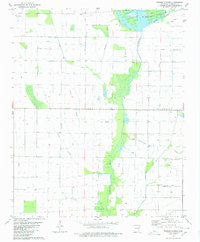
1980 Map of Powers Slough
USGS Topo · Published 1980About this map
L'Anguille River winds through the heart of this Poinsett County landscape, anchoring a network of drainage ditches, flumes, and natural watercourses characteristic of the Arkansas Delta. The 1980 state of the land reveals a sophisticated water management system designed to support the region's agricultural productivity, including the extensive Claypool Reservoir in the northern reaches. Scattered Landing Strips emphasize the reliance on aerial application for crop management across the flat, gridded terrain. Waterways like Bolivar Cr, Bear Branch, and England Creek provide natural drainage between the man-made flumes, while the meandering Powers Slough remains a distinctive feature of the local topography. This map documents the intersection of natural river systems and intensive land engineering in the late twentieth century.
Find a feature on this map
9 named features on this map. Tap any name to fly to it.
Don’t see what you’re looking for? This feature index may not catch every label — zoom into the map to look around manually.
Map Details
Editions of this 1980 Powers Slough Map
This is the sole edition of this map. No revisions or reprints were ever made.
Other maps of this area

1939 · Vanndale
USGS Topo · 1:62,500

1939 · Weiner
USGS Topo · 1:62,500

1940 · Princedale
USGS Topo · 1:62,500

1940 · Dee
USGS Topo · 1:62,500

1953 · Memphis
USGS Topo · 1:250,000

1956 · Memphis
USGS Topo · 1:250,000

1956 · Princedale
USGS Topo · 1:62,500

1958 · Dee
USGS Topo · 1:62,500

1958 · Vanndale
USGS Topo · 1:62,500

1959 · Weiner
USGS Topo · 1:62,500