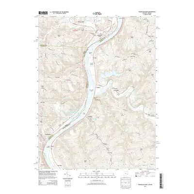
2013 Map of Powhatan Point
USGS Topo · Published 2013About this map
Powhatan Point stands as a significant riverfront community along the Ohio River where Captina Creek joins the main channel, anchoring a landscape shaped by industrial resource management and steep ridge topography. The 2013 survey details a complex system of water control structures associated with the Quarto Mine Number Four dams, which tier through the hills west of Woodlands. This area, spanning the border of Ohio and West Virginia, reflects generations of family settlement through its numerous upland burial grounds, including the Ebenezer and Grace Chapel cemeteries.
Find a feature on this map
143 named features on this map. Tap any name to fly to it.
Don’t see what you’re looking for? This feature index may not catch every label — zoom into the map to look around manually.
Map Details
Editions of this 2013 Powhatan Point Map
This is the sole edition of this map. No revisions or reprints were ever made.
Other maps of this area

1903 · Littleton
USGS Topo · 1:62,500

1904 · Cameron
USGS Topo · 1:62,500

1905 · Littleton
USGS Topo · 1:62,500

1905 · Clarington
USGS Topo · 1:62,500

1906 · New Martinsville
USGS Topo · 1:62,500

1924 · New Martinsville
USGS Topo · 1:62,500

1924 · Littleton
USGS Topo · 1:62,500

1926 · Littleton
USGS Topo · 1:62,500

1926 · New Martinsville
USGS Topo · 1:62,500

1935 · Cameron
USGS Topo · 1:62,500