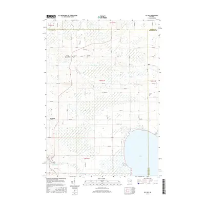
2016 Map of Poy Sippi
USGS Topo · Published 2016About this map
Lake Poygan defines the southeastern corner of this landscape, its waters meeting the low-lying wetlands that spread across the Waushara and Winnebago county lines. The settlement of Poy Sippi sits along the Pine River in the southwest, while the village of Tustin occupies the northern shore of the lake. This area is characterized by a high density of small rural communities and local family heritage sites, including West Bloomfield and Metz. Local history and genealogy are preserved in the locations of Concordia Cem, Saint Johns Cem, and Prellwitz Cem. The drainage pattern is led by Alder Cr and Mosquito Cr, which flow through a network of rural roads such as Co Rd HH and Alp Ave. Near the shoreline, Old Indian Point serves as a notable landmark where the land meets the marshy edges of the lake.
Find a feature on this map
66 named features on this map. Tap any name to fly to it.
Don’t see what you’re looking for? This feature index may not catch every label — zoom into the map to look around manually.
Map Details
Editions of this 2016 Poy Sippi Map
This is the sole edition of this map. No revisions or reprints were ever made.
Other maps of this area

1955 · Green Bay
USGS Topo · 1:250,000

1956 · Weyauwega
USGS Topo · 1:48,000

1957 · Waupaca
USGS Topo · 1:48,000

1961 · Poy Sippi
USGS Topo · 1:62,500

1961 · Redgranite
USGS Topo · 1:62,500

1961 · Saxeville
USGS Topo · 1:24,000

1961 · Lake Poygan
USGS Topo · 1:24,000
1961 · Redgranite
USGS Topo · 1:24,000
1961 · Auroraville
USGS Topo · 1:24,000
1961 · Eureka
USGS Topo · 1:24,000