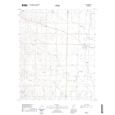
2020 Map of Poyen
USGS Topo · Published 2020About this map
Poyen serves as the central hub of this South Central Arkansas landscape, situated along a network of county roads and drainage systems. The town is flanked by smaller settlements like Lenham to the southeast and Fenter in the northeast, reflecting a decentralized rural development pattern. To the northwest, the Gifford Tram and Tram Cutoff suggest a history tied to local industry or transit, leading toward the community of Gifford.
Find a feature on this map
85 named features on this map. Tap any name to fly to it.
Don’t see what you’re looking for? This feature index may not catch every label — zoom into the map to look around manually.
Map Details
Editions of this 2020 Poyen Map
This is the sole edition of this map. No revisions or reprints were ever made.
Other maps of this area

1948 · Malvern
USGS Topo · 1:62,500

1949 · Malvern
USGS Topo · 1:62,500

1955 · Little Rock
USGS Topo · 1:250,000

1956 · Little Rock
USGS Topo · 1:250,000

1960 · Little Rock
USGS Topo · 1:250,000

1963 · Traskwood
USGS Topo · 1:24,000

1963 · Prattsville
USGS Topo · 1:24,000
1963 · Tull
USGS Topo · 1:24,000

1964 · Poyen
USGS Topo · 1:24,000

1964 · Little Rock
USGS Topo · 1:250,000