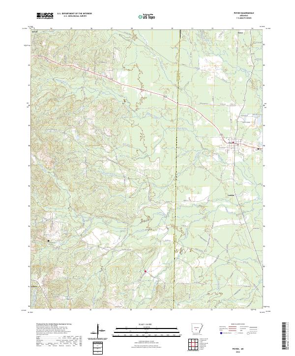
2024 Map of Poyen
USGS Topo · Published 2024About this map
The town of Poyen serves as the central hub of this modern survey at the junction of Highway 270 and Highway 229. The surrounding landscape reflects a transition between the timberlands and rural bottomlands of the Ouachita River valley, characterized by a dense network of waterways such as Francois Creek and Big Creek. Historical industry and transport legacy are evident in the presence of the Gifford Tram and Tram Cutoff in the northern portion of the quadrangle near Gifford, indicating the area's long-standing connection to local logging or industrial transport routes.
Find a feature on this map
87 named features on this map. Tap any name to fly to it.
Don’t see what you’re looking for? This feature index may not catch every label — zoom into the map to look around manually.
Map Details
Editions of this 2024 Poyen Map
This is the sole edition of this map. No revisions or reprints were ever made.
Other maps of this area

1948 · Malvern
USGS Topo · 1:62,500

1949 · Malvern
USGS Topo · 1:62,500

1955 · Little Rock
USGS Topo · 1:250,000

1956 · Little Rock
USGS Topo · 1:250,000

1960 · Little Rock
USGS Topo · 1:250,000

1963 · Traskwood
USGS Topo · 1:24,000

1963 · Prattsville
USGS Topo · 1:24,000
1963 · Tull
USGS Topo · 1:24,000

1964 · Poyen
USGS Topo · 1:24,000

1964 · Little Rock
USGS Topo · 1:250,000