Loading...
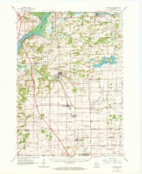
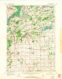
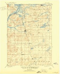
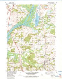
Loading map...1962 Map of Poynette
USGS Topo · Published 1972About this map
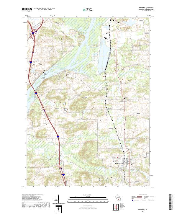
Poynette stands at the center of this early 1960s landscape, where the agricultural flats of Arlington meet the glacial wetlands of Schoenberg Marsh. The Chicago Milwaukee St Paul and Pacific railroad creates a diagonal axis through the terrain, connecting small rural centers like Morrisonville and Arlington. To the west, the Wisconsin River carves past Whites Bluff and Lib Cross Island, defining the boundary of Caledonia.
Find a feature on this map
70 named features on this map. Tap any name to fly to it.
Don’t see what you’re looking for? This feature index may not catch every label — zoom into the map to look around manually.
Map Details
Date Portrayed1962
Date Published1972
PublisherU.S. Geological Survey
Map TypeTopographic
Scale1:62,500
Physical Dimensions17.36 x 21.22 inches
Editions of this 1962 Poynette Map
2 editions found
Historical Maps of DeForest Through Time
4 maps found
Featured Locations
Source Details
SourceU.S. Geological Survey
CopyrightPublic Domain