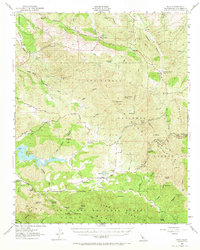
1952 Map of Pozo
USGS Topo · Published 1968About this map
Pozo and its surrounding ranchlands sit at the heart of this mid-century topographic record, where the Salinas River carves through the central hills of San Luis Obispo County. Based on surveys from 1918-1919 with 1952 revisions, the map reveals a landscape defined by isolated homesteads and mining activity, such as the Red Eagle Mine and Rinconada Mine. The newly formed Salinas Reservoir stands out against the older network of canyons and creeks, including Huerhuero Creek and Camatta Canyon. Small rural centers like Wilson Corner and Pippin Corner anchor the road system, while the Pozo Sch and local Cem serve as primary social markers for the valley's residents. Extensive portions of the Los Padres National Forest cover the terrain, marked by fire lookouts and camps like Navajo Camp and La Panza Camp, reflecting the area's transition into a managed wilderness and water resource zone.
Find a feature on this map
100 named features on this map. Tap any name to fly to it.
Don’t see what you’re looking for? This feature index may not catch every label — zoom into the map to look around manually.
Map Details
Editions of this 1952 Pozo Map
3 editions found
Other maps of this area

1897 · San Luis Obispo
USGS Topo · 1:62,500

1897 · Arroyo Grande
USGS Topo · 1:62,500

1900 · San Luis
USGS Topo · 1:125,000

1914 · Cholame
USGS Topo · 1:125,000

1915 · Cholame
USGS Topo · 1:125,000

1917 · Cholame
USGS Topo · 1:125,000

1919 · Paso Robles
USGS Topo · 1:62,500

1922 · Pozo
USGS Topo · 1:62,500

1922 · Nipomo
USGS Topo · 1:62,500

1932 · La Panza
USGS Topo · 1:48,000