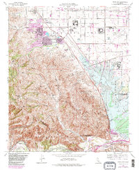
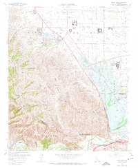
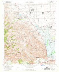
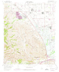
1967 Map of Prado Dam
USGS Topo · Published 1982About this map
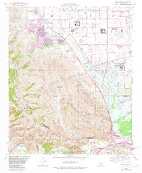
The Prado Dam and its adjacent Prado Flood Control Basin anchor this landscape at the intersection of San Bernardino, Riverside, and Orange counties. In the early 1980s, the area reflects a transition from ranching and institutional land use toward suburban development, particularly around Los Serranos and the southern edge of Chino. Significant acreage is dedicated to state facilities, including the California Institution for Men and the California Institution for Women (Frontera PO), while the Chino Airport sits in the northeast.
Find a feature on this map
41 named features on this map. Tap any name to fly to it.
Don’t see what you’re looking for? This feature index may not catch every label — zoom into the map to look around manually.
Map Details
Editions of this 1967 Prado Dam Map
5 editions found
Other maps of this area

1894 · Pomona
USGS Topo · 1:62,500

1896 · Anaheim
USGS Topo · 1:62,500

1897 · Pomona
USGS Topo · 1:62,500

1897 · Cucamonga
USGS Topo · 1:62,500

1898 · Pomona
USGS Topo · 1:62,500

1898 · Anaheim
USGS Topo · 1:62,500

1900 · Cucamonga
USGS Topo · 1:62,500

1901 · Southern California Sheet No. 1
USGS Topo · 1:250,000

1901 · Anaheim
USGS Topo · 1:62,500

1902 · Corona
USGS Topo · 1:125,000