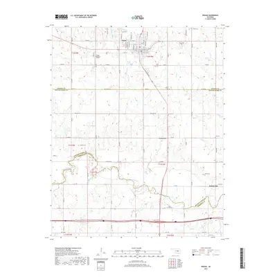
2018 Map of Prague
USGS Topo · Published 2018About this map
Prague stands as a central hub on this 2018 survey, where the grid of Main St and S Jim Thorpe Blvd meets a landscape defined by its deep Central Oklahoma roots. The geography here is marked by its heritage, most notably at the Czech National Cem and Saint Wenceslaus Cem, reflecting the cultural history of the settlement. The northern reaches of the quadrangle are primarily drained by Sand Cr and Shell Cr, while the southern portion is dominated by the meandering course of the North Canadian River.
Find a feature on this map
57 named features on this map. Tap any name to fly to it.
Don’t see what you’re looking for? This feature index may not catch every label — zoom into the map to look around manually.
Map Details
Editions of this 2018 Prague Map
This is the sole edition of this map. No revisions or reprints were ever made.
Other maps of this area

1896 · Seminole and Prague
USGS Topo · 1:125,000

1905 · Chandler
USGS Topo · 1:62,500

1907 · Chandler
USGS Topo · 1:62,500

1909 · Shawnee
USGS Topo · 1:62,500

1929 · Stroud
USGS Topo · 1:62,500

1932 · Stroud
USGS Topo · 1:62,500

1954 · Oklahoma City
USGS Topo · 1:250,000

1957 · Oklahoma City
USGS Topo · 1:250,000

1963 · Oklahoma City
USGS Topo · 1:250,000

1967 · Prague SW
USGS Topo · 1:24,000