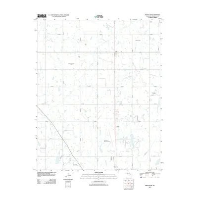
2012 Map of Prague SW
USGS Topo · Published 2012About this map
The Keokuk Oil Field and North Searight Oil Field define the industrial footprint of this central Oklahoma landscape north of Seminole. The grid-like arrangement of rural roads, such as NS 3550 and E 1160 RD, connects numerous family-named burial grounds including Harjo Cem, Payne Cem, and Bruner Cem, which serve as vital markers for local genealogical research. This survey also shows the rural settlement of Little and the Seminole Municipal Airport near the confluence of Magnolia Cr and Carter Cr. The terrain is characterized by a network of drainage systems like Turkey Cr and Snake Cr, interspersed with oil extraction sites that reflect the area's long-standing reliance on the petroleum industry.
Find a feature on this map
41 named features on this map. Tap any name to fly to it.
Don’t see what you’re looking for? This feature index may not catch every label — zoom into the map to look around manually.
Map Details
Editions of this 2012 Prague SW Map
This is the sole edition of this map. No revisions or reprints were ever made.
Other maps of this area

1896 · Seminole and Prague
USGS Topo · 1:125,000

1907 · Maud
USGS Topo · 1:62,500

1908 · Maud
USGS Topo · 1:62,500

1909 · Shawnee
USGS Topo · 1:62,500

1954 · Oklahoma City
USGS Topo · 1:250,000

1957 · Oklahoma City
USGS Topo · 1:250,000

1963 · Oklahoma City
USGS Topo · 1:250,000

1967 · Prague SW
USGS Topo · 1:24,000
1967 · Earlsboro
USGS Topo · 1:24,000

1967 · Prague NE
USGS Topo · 1:24,000