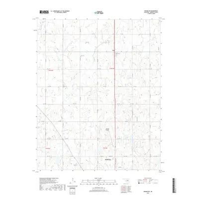
2018 Map of Prague SW
USGS Topo · Published 2018About this map
Seminole serves as the focal point for this survey of central Oklahoma, illustrating the northern reach of the city's modern infrastructure. The landscape is defined by the convergence of چندین waterways, including Magnolia Cr and Turkey Cr, which drain the varied terrain surrounding the Seminole Municipal Airport. To the north, the small community of Little preserves a distinct local character, anchored by the Little Cem. Genealogists will find particular value in the documentation of family-named sites such as Payne Cem and Bruner Cem, which are situated among a rectilinear grid of section-line roads like ns3540 RD and Ew 1160 RD. The layout of these transit corridors, including N Milt Phillips Ave, reflects the region's historical development patterns and agricultural roots.
Find a feature on this map
43 named features on this map. Tap any name to fly to it.
Don’t see what you’re looking for? This feature index may not catch every label — zoom into the map to look around manually.
Map Details
Editions of this 2018 Prague SW Map
This is the sole edition of this map. No revisions or reprints were ever made.
Other maps of this area

1896 · Seminole and Prague
USGS Topo · 1:125,000

1907 · Maud
USGS Topo · 1:62,500

1908 · Maud
USGS Topo · 1:62,500

1909 · Shawnee
USGS Topo · 1:62,500

1954 · Oklahoma City
USGS Topo · 1:250,000

1957 · Oklahoma City
USGS Topo · 1:250,000

1963 · Oklahoma City
USGS Topo · 1:250,000

1967 · Prague SW
USGS Topo · 1:24,000
1967 · Earlsboro
USGS Topo · 1:24,000

1967 · Prague NE
USGS Topo · 1:24,000