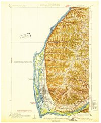
1932 Map of Prairie Du Chien
USGS Topo · Published 1932About this map
The Prairie Du Chien riverfront dominates this 1932 survey, illustrating the complex intersection of the Mississippi River and Wisconsin River during the early thirties. This sheet details a landscape of deep coulees and ridges, where isolated country schools like Wall Ridge Sch and Sioux Coulee Sch served the surrounding farmstead communities. The western edge is defined by a dense network of river features, including Ambro Slough, Marais Lake, and Roseau Island, while the eastern highlands are marked by the Wauzeka Ridge. Transportation is anchored by the Chicago Milwaukee St Paul and Pacific railroad and early state trunk highways. For genealogists, the map preserves the exact locations of rural burial grounds such as Shaw Hill Cem and Bonney Cem, alongside numerous family-named landmarks like Du Charme Ridge and Limery Coulee.
Find a feature on this map
75 named features on this map. Tap any name to fly to it.
Don’t see what you’re looking for? This feature index may not catch every label — zoom into the map to look around manually.
Map Details
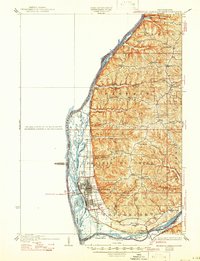
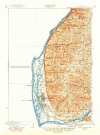
Editions of this 1932 Prairie Du Chien Map
4 editions found

Other maps of this area

1900 · Lancaster
USGS Topo · 1:125,000

1902 · Elkader
USGS Topo · 1:125,000

1903 · Waukon
USGS Topo · 1:125,000

1904 · Lancaster
USGS Topo · 1:125,000

1908 · Lancaster
USGS Topo · 1:125,000

1924 · Gays Mills
USGS Topo · 1:62,500

1926 · Gays Mills
USGS Topo · 1:62,500

1926 · Wauzeka
USGS Topo · 1:62,500

1929 · Ferryville
USGS Topo · 1:62,500

1929 · Prairie Du Chien
USGS Topo · 1:62,500