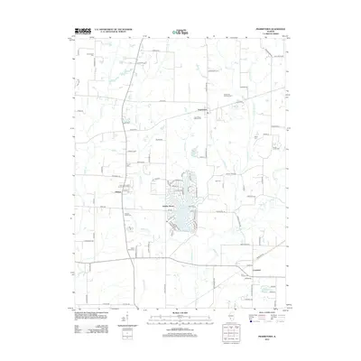
2012 Map of Prairietown
USGS Topo · Published 2012About this map
Holiday Lake sits at the center of this Madison County landscape, surrounded by the suburban development of Holiday Shores. In contrast to the residential density around the lake, the surrounding terrain is defined by a network of creeks and small family-named landmarks that hint at an older agricultural foundation. Tributaries like Sherry Cr, Paddock Cr, and the larger Cahokia Cr drain the area, while several cemeteries, such as the Paddock Family Cem and Liberty Prairie Cem, reflect the early settlement history of this rural Illinois prairie. The small crossroads of Prairietown, Midway, and Carpenter anchor the local road network, which still maintains a predominantly grid-like structure typical of Midwestern farming communities. The map highlights the coexistence of newer lakeside living with traditional sites like the Saint Peters Lutheran Cem and Zion Lutheran Cem.
Find a feature on this map
103 named features on this map. Tap any name to fly to it.
Don’t see what you’re looking for? This feature index may not catch every label — zoom into the map to look around manually.
Map Details
Editions of this 2012 Prairietown Map
This is the sole edition of this map. No revisions or reprints were ever made.
Other maps of this area

1912 · Gillespie
USGS Topo · 1:62,500

1915 · Gillespie
USGS Topo · 1:62,500

1925 · Brighton
USGS Topo · 1:62,500

1927 · Alton
USGS Topo · 1:62,500

1927 · Edwardsville
USGS Topo · 1:62,500

1928 · Brighton
USGS Topo · 1:62,500

1932 · Edwardsville
USGS Topo · 1:62,500

1934 · Alton
USGS Topo · 1:62,500

1948 · Quincy
USGS Topo · 1:250,000

1948 · Wood River
USGS Topo · 1:24,000