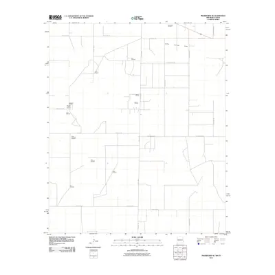
2010 Map of Prairieview NE
USGS Topo · Published 2010About this map
Murphys Chapel and its associated Murphys Chapel Cemetery serve as a primary landmark in this ranching landscape along the New Mexico-Texas border. The terrain is characterized by a grid of rural roads, including State Line Rd and Old Lovington Rd, which navigate the open country between the Bronco Oil Field and the ephemeral course of Sulfer Springs Draw. A distinct pattern of agricultural and ranching infrastructure is visible through the numerous named water sources scattered across the map, such as Boardman Windmill, Rogers Windmill, and Mutt Windmill. This 2010 survey illustrates the continued importance of individual water points and petroleum extraction in Lea County, showing a landscape where local history is anchored by family-named landmarks like Koch Windmill and the North Townsend Windmill.
Find a feature on this map
28 named features on this map. Tap any name to fly to it.
Don’t see what you’re looking for? This feature index may not catch every label — zoom into the map to look around manually.
Map Details
Editions of this 2010 Prairieview NE Map
This is the sole edition of this map. No revisions or reprints were ever made.
Other maps of this area

1954 · Brownfield
USGS Topo · 1:250,000

1958 · Brownfield
USGS Topo · 1:250,000

1962 · Brownfield
USGS Topo · 1:250,000

1970 · Prairieview
USGS Topo · 1:24,000

1970 · Prairieview NE
USGS Topo · 1:24,000

1970 · Prairieview NW
USGS Topo · 1:24,000

1970 · Gladiola
USGS Topo · 1:24,000

1970 · Bronco
USGS Topo · 1:24,000

1970 · Prairieview SE
USGS Topo · 1:24,000

1971 · Plains NW
USGS Topo · 1:24,000