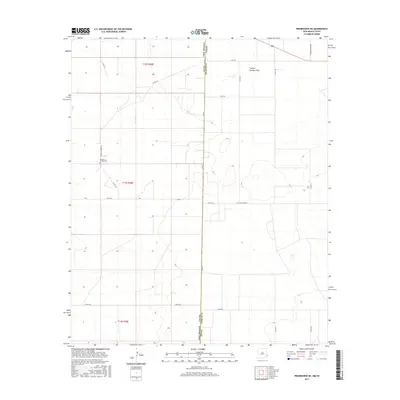
2017 Map of Prairieview NE
USGS Topo · Published 2017About this map
New Mexico and Texas meet along a straight meridian, where the high plains of Lea County and Yoakum County share a quiet, agricultural landscape. This borderland is defined by a strictly surveyed grid of county roads, including Old Lovington Rd and Murphy Chapel Rd, which navigate a terrain marked by subtle depressions and the broad passage of Sulphur Springs Draw. Central to the area's local history is the Murphys Chapel Cem, a small landmark that serves as a focal point for genealogy in this corner of the Llano Estacado. The map reveals the late-2010s infrastructure of the region, where state highways like FM 769 cross section lines and local routes such as Koch Rd provide access to the expansive ranching and farming tracts that characterize the New Mexico-Texas line.
Find a feature on this map
23 named features on this map. Tap any name to fly to it.
Don’t see what you’re looking for? This feature index may not catch every label — zoom into the map to look around manually.
Map Details
Editions of this 2017 Prairieview NE Map
This is the sole edition of this map. No revisions or reprints were ever made.
Other maps of this area

1954 · Brownfield
USGS Topo · 1:250,000

1958 · Brownfield
USGS Topo · 1:250,000

1962 · Brownfield
USGS Topo · 1:250,000

1970 · Prairieview
USGS Topo · 1:24,000

1970 · Prairieview NE
USGS Topo · 1:24,000

1970 · Prairieview NW
USGS Topo · 1:24,000

1970 · Gladiola
USGS Topo · 1:24,000

1970 · Bronco
USGS Topo · 1:24,000

1970 · Prairieview SE
USGS Topo · 1:24,000

1971 · Plains NW
USGS Topo · 1:24,000