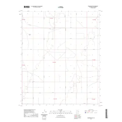
2023 Map of Prairieview NW
USGS Topo · Published 2023About this map
King Cem serves as a small, significant marker of local heritage within this stretch of the Llano Estacado. The landscape is primarily defined by the wide depression of Eightmile Draw, which cuts across the northwest, while the remainder of the terrain is organized by a strict grid of county roads and section lines typical of eastern New Mexico. Significant local corridors like Gladiola Rd and Travis Rd connect the scattered ranching and residential sites. The mapping of named paths such as S Comanche St and Herrera Ln alongside rural junctions like Harbison provides a clear view of the modern settlement pattern and land use in Lea County.
Find a feature on this map
34 named features on this map. Tap any name to fly to it.
Don’t see what you’re looking for? This feature index may not catch every label — zoom into the map to look around manually.
Map Details
Editions of this 2023 Prairieview NW Map
This is the sole edition of this map. No revisions or reprints were ever made.
Other maps of this area

1954 · Brownfield
USGS Topo · 1:250,000

1958 · Brownfield
USGS Topo · 1:250,000

1962 · Brownfield
USGS Topo · 1:250,000

1970 · Prairieview
USGS Topo · 1:24,000

1970 · Prairieview NE
USGS Topo · 1:24,000

1970 · Prairieview NW
USGS Topo · 1:24,000

1970 · Gladiola
USGS Topo · 1:24,000

1970 · Hillburn City
USGS Topo · 1:24,000

1970 · Tatum South
USGS Topo · 1:24,000

1970 · Bronco
USGS Topo · 1:24,000