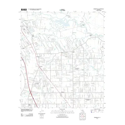
2012 Map of Prairieville
USGS Topo · Published 2012About this map
Prairieville and its surrounding communities are mapped here at a time of suburban expansion into the lowlands of the Amite River basin. The landscape is defined by the winding course of Bayou Manchac and the intricate network of the Grand Goudine Bayou, where family history is preserved in small burial grounds like Myford Cem and Hillman Cem. The map illustrates the shift from a rural parish towards a more developed residential area, seen in the growth of Dutch Town and Duplessis. Industrial and public works footprints are evident at the Mallets Bluff Oil Field and the Southwood Village Wastewater Treatment Facility. Local aviation is represented by Capozzoli Airport and Don Babin Airport, providing a clear record of regional infrastructure just after the turn of the millennium. Notable landmarks include the Richards Gardens of Memory Cem and several local campuses such as Dutchtown High School.
Find a feature on this map
380 named features on this map. Tap any name to fly to it.
Don’t see what you’re looking for? This feature index may not catch every label — zoom into the map to look around manually.
Map Details
Editions of this 2012 Prairieville Map
This is the sole edition of this map. No revisions or reprints were ever made.
Other maps of this area

1892 · Donaldsonville
USGS Topo · 1:62,500

1908 · Baton Rouge
USGS Topo · 1:62,500

1934 · Denham Springs
USGS Topo · 1:62,500

1935 · Gonzales
USGS Topo · 1:31,680

1936 · White Castle
USGS Topo · 1:62,500

1939 · Denham Springs
USGS Topo · 1:62,500

1939 · Baton Rouge
USGS Topo · 1:62,500

1939 · Donaldsonville
USGS Topo · 1:62,500

1947 · Sorrento
USGS Topo · 1:31,680

1953 · Walker
USGS Topo · 1:24,000