
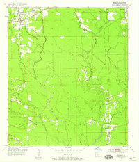
1953 Map of Walker
USGS Topo · Published 1954About this map
The Illinois Central railroad corridor anchors the northern edge of this Livingston Parish landscape, connecting the settlements of Walker and Corbin during the early 1950s. The terrain is defined by a dense network of branching waterways, most notably Middle Colyell Creek and West Colyell Creek, which flow southward through rural stretches marked by family and community landmarks. Local genealogy is preserved in the locations of Palmetto Cem and Petes Rest Cem, along with several country churches like Satsuma Ch and Plainview Ch. The presence of the Walker Lookout Tower suggests a landscape managed for timber or fire watch, while the Frost Sch in the southeast corner serves as a focal point for the surrounding rural community. This period shows the transition of the region from a purely rail-dependent economy to one with a growing network of roads branching into the bayou-laced interior.
Find a feature on this map
22 named features on this map. Tap any name to fly to it.
Don’t see what you’re looking for? This feature index may not catch every label — zoom into the map to look around manually.
Map Details
Editions of this 1953 Walker Map
2 editions found
Other maps of this area

1934 · Denham Springs
USGS Topo · 1:62,500

1934 · Springfield
USGS Topo · 1:62,500

1939 · Springfield
USGS Topo · 1:62,500

1939 · Denham Springs
USGS Topo · 1:62,500

1942 · Watson
USGS Topo · 1:31,680

1942 · Satsuma
USGS Topo · 1:31,680

1950 · Doyle
USGS Topo · 1:31,680
1953 · Prairieville
USGS Topo · 1:24,000
1953 · French Settlement
USGS Topo · 1:24,000
1953 · Denham Springs
USGS Topo · 1:24,000