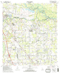
1991 Map of Prairieville
USGS Topo · Published 1991About this map
Manchac Bayou winds through the heart of this landscape, marking the historical boundary between East Baton Rouge and Ascension Parishes. The area is defined by a dense network of waterways including Boggy Bayou, Cotton Bayou, and Goudine Bayou, reflecting the intricate drainage of the Louisiana lowlands. Settlement is concentrated along higher ground and road corridors, with clusters of community life centered on Prairieville, Galvez, and Duplessis.
Find a feature on this map
71 named features on this map. Tap any name to fly to it.
Don’t see what you’re looking for? This feature index may not catch every label — zoom into the map to look around manually.
Map Details
Editions of this 1991 Prairieville Map
2 editions found
Other maps of this area

1892 · Donaldsonville
USGS Topo · 1:62,500

1908 · Baton Rouge
USGS Topo · 1:62,500

1934 · Denham Springs
USGS Topo · 1:62,500

1935 · Gonzales
USGS Topo · 1:31,680

1936 · White Castle
USGS Topo · 1:62,500

1939 · Denham Springs
USGS Topo · 1:62,500

1939 · Baton Rouge
USGS Topo · 1:62,500

1939 · Donaldsonville
USGS Topo · 1:62,500

1947 · Sorrento
USGS Topo · 1:31,680

1953 · Walker
USGS Topo · 1:24,000