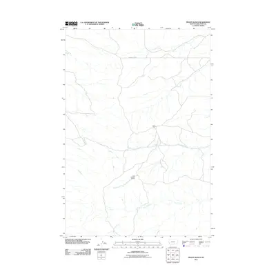
2011 Map of Prante Ranch
USGS Topo · Published 2011About this map
Prante Ranch serves as the namesake landmark for this Big Horn County region, situated within a landscape defined by significant watercourse networks and ranching infrastructure. The drainage systems of Dawussuua Ashkaate and its tributary, the South Fork Dawussuua Ashkaate, dominate the central topography, while Onion Creek winds through the southern portion of the quadrangle. A key piece of water management is visible at the Crow Number 45 Dam, which regulates local flow. Transportation through this part of the Crow Reservation is facilitated by routes like the Crow-St X Cutoff, illustrating the practical connectivity between isolated ranching outposts and larger regional thoroughfares in the early 21st century.
Find a feature on this map
6 named features on this map. Tap any name to fly to it.
Don’t see what you’re looking for? This feature index may not catch every label — zoom into the map to look around manually.
Map Details
Editions of this 2011 Prante Ranch Map
This is the sole edition of this map. No revisions or reprints were ever made.
Other maps of this area

1894 · Rosebud
USGS Topo · 1:125,000

1894 · St. Xavier
USGS Topo · 1:125,000

1894 · Fort Custer
USGS Topo · 1:125,000

1901 · Rosebud
USGS Topo · 1:125,000

1901 · St. Xavier
USGS Topo · 1:125,000

1954 · Hardin
USGS Topo · 1:250,000

1957 · Hardin
USGS Topo · 1:250,000

1958 · Hardin
USGS Topo · 1:250,000

1960 · St Xavier
USGS Topo · 1:24,000

1960 · Walker Hill
USGS Topo · 1:24,000