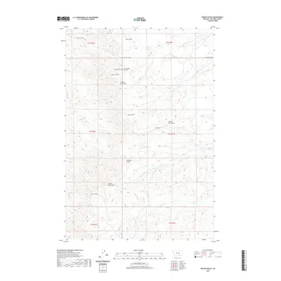
2020 Map of Prante Ranch
USGS Topo · Published 2020About this map
Prante Ranch sits at the center of this Big Horn County landscape, where complex drainage systems and seasonal waterways define the terrain. The naming conventions throughout this territory reflect both local family history and traditional Indigenous identifiers, seen in features like Dawussuua Ashkaate and its South Fork. The map shows a region shaped by intermittent coulees, including Halfway House Coulee and Humphrey Coulee, which serve as vital topographic markers in this expansive area. Transportation is limited to a few primary arteries like the Crow-St Xavier Rd and the Crow-St X Cutoff, highlighting the ranch-centered nature of the local economy and land use. Small-scale water features like Onion Cr and Spotted Tail Coulee further illustrate the detailed hydrologic network essential to managing livestock and land in southern Montana.
Find a feature on this map
21 named features on this map. Tap any name to fly to it.
Don’t see what you’re looking for? This feature index may not catch every label — zoom into the map to look around manually.
Map Details
Editions of this 2020 Prante Ranch Map
This is the sole edition of this map. No revisions or reprints were ever made.
Other maps of this area

1894 · Rosebud
USGS Topo · 1:125,000

1894 · St. Xavier
USGS Topo · 1:125,000

1894 · Fort Custer
USGS Topo · 1:125,000

1901 · Rosebud
USGS Topo · 1:125,000

1901 · St. Xavier
USGS Topo · 1:125,000

1954 · Hardin
USGS Topo · 1:250,000

1957 · Hardin
USGS Topo · 1:250,000

1958 · Hardin
USGS Topo · 1:250,000

1960 · St Xavier
USGS Topo · 1:24,000

1960 · Walker Hill
USGS Topo · 1:24,000