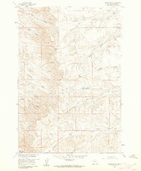
1960 Map of Prante Ranch
USGS Topo · Published 1962About this map
Prante Ranch serves as the namesake hub of this Montana landscape, a region defined by a complex network of dry washes and seasonal drainage channels known as coulees. Surveyed in 1960, the area shows a distinct pattern of ranching life where water is the primary geographic driver, evidenced by the numerous Spring labels and isolated Well sites. The terrain is crisscrossed by an extensive system of Jeep Trails, providing the only access to remote corners like Spotted Tail Coulee and Onion Creek.
Find a feature on this map
17 named features on this map. Tap any name to fly to it.
Don’t see what you’re looking for? This feature index may not catch every label — zoom into the map to look around manually.
Map Details
Editions of this 1960 Prante Ranch Map
This is the sole edition of this map. No revisions or reprints were ever made.
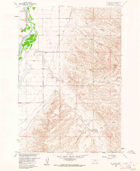
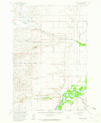
Other maps of this area

1894 · Rosebud
USGS Topo · 1:125,000

1894 · St. Xavier
USGS Topo · 1:125,000

1894 · Fort Custer
USGS Topo · 1:125,000

1901 · Rosebud
USGS Topo · 1:125,000

1901 · St. Xavier
USGS Topo · 1:125,000

1954 · Hardin
USGS Topo · 1:250,000

1957 · Hardin
USGS Topo · 1:250,000

1958 · Hardin
USGS Topo · 1:250,000
1960 · St Xavier
USGS Topo · 1:24,000
1960 · Walker Hill
USGS Topo · 1:24,000