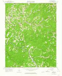
1963 Map of Prater
USGS Topo · Published 1964About this map
The Russell Fork and Russell Prater Creek carve through the deep hollows of the Cumberland Plateau in this 1963 survey of the Virginia highlands. The map centers on the small mountain community of Prater at the junction of several drainage branches, illustrating a landscape where roads like the Jeb Stuart Highway are forced to follow the winding path of the river valleys. The border between Dickenson and Buchanan Counties meanders across these ridges, passing notable landmarks such as Butcherknife and Painter Lick.
Find a feature on this map
68 named features on this map. Tap any name to fly to it.
Don’t see what you’re looking for? This feature index may not catch every label — zoom into the map to look around manually.
Map Details
Editions of this 1963 Prater Map
Other maps of this area

1886 · Grundy
USGS Topo · 1:125,000

1890 · Grundy
USGS Topo · 1:125,000

1892 · Grundy
USGS Topo · 1:125,000

1913 · Clintwood
USGS Topo · 1:62,500

1914 · Bucu
USGS Topo · 1:48,000

1914 · Hurley
USGS Topo · 1:48,000

1915 · Clintwood
USGS Topo · 1:62,500

1915 · Regina
USGS Topo · 1:48,000

1915 · Hurley
USGS Topo · 1:48,000

1916 · Bucu
USGS Topo · 1:62,500