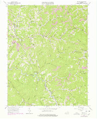
1963 Map of Prater
USGS Topo · Published 1978About this map
Prater and Vicey sit within a landscape defined by the deep valleys of Russell Prater Creek and its many tributaries, such as Greenbrier Creek and Pawpaw Creek. The 1963 survey, updated with late-1970s aerial data, reveals a community structure tied to these hollows, where small settlements like Viers and Leemaster are joined by a network of country churches and schools. Local history is recorded in the names of landmarks like Butcherknife Br, Painter Lick Br, and Tilda Anderson Branch.
Find a feature on this map
107 named features on this map. Tap any name to fly to it.
Don’t see what you’re looking for? This feature index may not catch every label — zoom into the map to look around manually.
Map Details
Editions of this 1963 Prater Map
Other maps of this area

1886 · Grundy
USGS Topo · 1:125,000

1890 · Grundy
USGS Topo · 1:125,000

1892 · Grundy
USGS Topo · 1:125,000

1913 · Clintwood
USGS Topo · 1:62,500

1914 · Bucu
USGS Topo · 1:48,000

1914 · Hurley
USGS Topo · 1:48,000

1915 · Clintwood
USGS Topo · 1:62,500

1915 · Regina
USGS Topo · 1:48,000

1915 · Hurley
USGS Topo · 1:48,000

1916 · Bucu
USGS Topo · 1:62,500