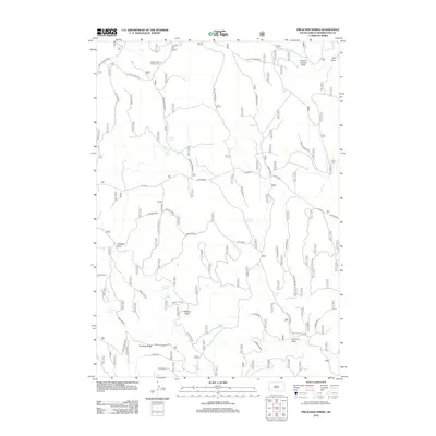
2012 Map of Preacher Spring
USGS Topo · Published 2012About this map
Preacher Spring and its surrounding network of aquifers define this high-country landscape in Pennington County, where a pattern of springs and draws supports local ranching operations. The Howell Ranch serves as a primary landmark in the western portion of the quadrangle, situated near the prominent Howell Ridge and the Park Spring trailhead. The area's hydrology is characterized by numerous seasonal and permanent water sources, including Briggs Spring, White Spring, and Johnson Spring, which drain into complex systems like Redbird Draw and Gillette Canyon. This mapping illustrates the critical importance of water management in the region, featuring infrastructure such as Boggy Reservoir and recreational sites like the Redbank Spring Campground near S Castle Creek. Transport routes like Six Mile Rd and Custer Limestone Rd navigate the ridgelines of Dumbuk Ridge, connecting these vital watering points across the varied terrain.
Find a feature on this map
34 named features on this map. Tap any name to fly to it.
Don’t see what you’re looking for? This feature index may not catch every label — zoom into the map to look around manually.
Map Details
Editions of this 2012 Preacher Spring Map
This is the sole edition of this map. No revisions or reprints were ever made.
Other maps of this area

1894 · Deadwood
USGS Topo · 1:125,000

1896 · Harney Peak
USGS Topo · 1:125,000

1898 · Sundance
USGS Topo · 1:125,000

1899 · Newcastle
USGS Topo · 1:125,000

1901 · Harney Peak
USGS Topo · 1:125,000

1901 · Deadwood
USGS Topo · 1:125,000

1901 · Newcastle
USGS Topo · 1:125,000

1902 · Sundance
USGS Topo · 1:125,000

1916 · Deadwood
USGS Topo · 1:125,000

1951 · Fanny Peak
USGS Topo · 1:24,000