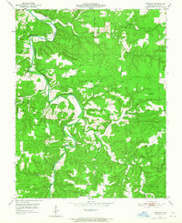
1951 Map of Prescott
USGS Topo · Published 1965About this map
The Big Piney River winds through the central Ozarks in the early 1950s, creating a deeply incised landscape within the Mark Twain National Forest. The small settlement of Prescott serves as a local anchor, supported by rural institutions such as Prescott Ch and Cantrell Ch. This survey illustrates a mid-century transition in education, showing a network of country schools including Arthur Creek Sch, Pine Ridge Sch, and the already labeled Whitlock Sch (Abandoned).
Find a feature on this map
45 named features on this map. Tap any name to fly to it.
Don’t see what you’re looking for? This feature index may not catch every label — zoom into the map to look around manually.
Map Details
Editions of this 1951 Prescott Map
5 editions found
Other maps of this area

1937 · Edgar Springs
USGS Topo · 1:48,000

1941 · Big Piney
USGS Topo · 1:62,500

1941 · Bado
USGS Topo · 1:62,500

1943 · Big Piney
USGS Topo · 1:62,500

1943 · Bado
USGS Topo · 1:62,500

1945 · Edgar Springs
USGS Topo · 1:62,500

1949 · Rolla
USGS Topo · 1:250,000

1951 · Licking
USGS Topo · 1:24,000

1951 · Raymondville
USGS Topo · 1:24,000

1951 · Prescott
USGS Topo · 1:24,000