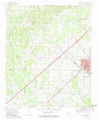
1970 Map of Prescott West
USGS Topo · Published 1983About this map
Prescott and Northwestern and Missouri Pacific railroad corridors converge in this 1970 snapshot of the Arkansas landscape. The city of Prescott serves as a central hub, featuring critical local infrastructure including the Courthouse, County Fairground, and Waterworks. The surrounding rural expanse is defined by a network of established family and community landmarks, particularly churches and burial grounds like Beards Chapel Cem and Artesian Cem. The survey reveals a terrain shaped by various watercourses such as Brushy Creek and Steel Creek, with the political boundary between Hempstead and Nevada counties cutting through the western sections. Evidence of local industry appears at the Gravel Pit near the northern edge, while the presence of the Prescott Country Club and a Lookout Tower reflect the recreational and civic life of the era.
Find a feature on this map
52 named features on this map. Tap any name to fly to it.
Don’t see what you’re looking for? This feature index may not catch every label — zoom into the map to look around manually.
Map Details
Editions of this 1970 Prescott West Map
2 editions found
Other maps of this area

1901 · Gurdon
USGS Topo · 1:125,000

1951 · Blevins
USGS Topo · 1:24,000

1951 · Pisgah
USGS Topo · 1:24,000

1951 · Hope
USGS Topo · 1:24,000

1953 · El Dorado
USGS Topo · 1:250,000

1957 · El Dorado
USGS Topo · 1:250,000

1958 · El Dorado
USGS Topo · 1:250,000

1960 · El Dorado
USGS Topo · 1:250,000

1970 · Prescott East
USGS Topo · 1:24,000
1970 · Prescott West
USGS Topo · 1:24,000