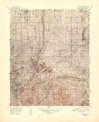
1948 Map of Prescott
USGS Topo · Published 1948About this map
The high desert and mountain transition of Central Arizona is documented here following World War II, centered on the historic city of Prescott. This landscape reflects a complex layering of land use, from the Whipple Military Reservation and Yavapai Ind Res to the emerging aviation infrastructure at Ernest A Love Municipal Airfield. Water management is prominent, shown through the Agua Fria River and the reservoirs at Willow Cr Reservoir and Watson Lake Reservoir. The map illustrates a transportation-driven economy where the Atchison Topeka and Santa Fe railroad serves northern outposts like Chino Valley and Granite Siding. Mining history remains visible at the Old Hopkins Mine, while the southern reaches are dominated by the timber and recreation lands of the Prescott National Forest.
Find a feature on this map
29 named features on this map. Tap any name to fly to it.
Don’t see what you’re looking for? This feature index may not catch every label — zoom into the map to look around manually.
Map Details
Editions of this 1948 Prescott Map
4 editions found

Other maps of this area

1887 · Prescott
USGS Topo · 1:250,000

1892 · Prescott
USGS Topo · 1:250,000

1903 · Bradshaw Mountains
USGS Topo · 1:125,000

1903 · Congress
USGS Topo · 1:125,000

1904 · Congress
USGS Topo · 1:125,000

1905 · Jerome
USGS Topo · 1:125,000

1944 · Clarkdale
USGS Topo · 1:48,000

1944 · Mingus Mountain
USGS Topo · 1:62,500

1947 · Mingus Mtn
USGS Topo · 1:62,500

1947 · Mayer
USGS Topo · 1:62,500