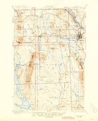
1935 Map of Presque Isle
USGS Topo · Published 1945About this map
The Aroostook River and the Bangor and Aroostook railroad corridor define this mid-1930s landscape, serving as the industrial and transportation backbone for the eastern portion of the quadrangle. In Presque Isle, the presence of the Aroostook State Normal School and the State Experimental Farm signals the area's dual identity as a center for both higher education and agricultural research. Beyond the municipal centers, the landscape is punctuated by a dense network of one-room schoolhouses, such as the Morin Sch, Dudley Sch, and Grendell Sch, which reflect the decentralized rural settlement patterns of the era. To the west and south, the terrain rises toward Hedgehog Mountain and Green Mountain, while Squapan Lake dominates the southwestern corner. These more remote reaches contain specialized locations like Swanback Clearing and Huson Landing, hinting at the region's logging and recreational heritage.
Find a feature on this map
109 named features on this map. Tap any name to fly to it.
Don’t see what you’re looking for? This feature index may not catch every label — zoom into the map to look around manually.
Map Details
Editions of this 1935 Presque Isle Map
3 editions found

Other maps of this area

1929 · Portage
USGS Topo · 1:62,500

1929 · Caribou
USGS Topo · 1:48,000

1930 · Fort Fairfield
USGS Topo · 1:48,000

1931 · Ashland
USGS Topo · 1:48,000

1931 · Portage
USGS Topo · 1:62,500

1932 · Caribou
USGS Topo · 1:62,500

1933 · Fort Fairfield
USGS Topo · 1:62,500

1934 · Bridgewater
USGS Topo · 1:48,000

1934 · Ashland
USGS Topo · 1:62,500

1935 · Howe Brook
USGS Topo · 1:48,000