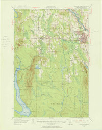
1953 Map of Presque Isle
USGS Topo · Published 1965About this map
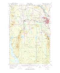
Presque Isle Air Force Base dominates the landscape north of the city center in this mid-century portrait of Maine's agricultural heartland. The surrounding terrain is a mosaic of cultivated ridges and wooded summits, including Hedgehog Mountain and Haystack Mtn, reflecting the intensive potato farming economy of the era. The presence of the State Experimental Farm and Aroostook State Teachers College underscores the community's role as a regional hub for education and agricultural research. Local infrastructure is anchored by the Bangor and Aroostook railroad, which follows the winding course of the Aroostook River. In the outlying townships, small rural nodes like Deadmans Cor and Mapleton appear alongside remote landmarks such as the Fire Tower on Bald Knob and the quiet shores of Squapan Lake.
Find a feature on this map
62 named features on this map. Tap any name to fly to it.
Don’t see what you’re looking for? This feature index may not catch every label — zoom into the map to look around manually.
Map Details
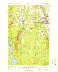
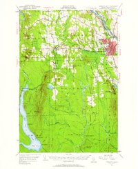
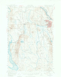
Editions of this 1953 Presque Isle Map
5 editions found
Other maps of this area

1929 · Portage
USGS Topo · 1:62,500

1929 · Caribou
USGS Topo · 1:48,000

1930 · Fort Fairfield
USGS Topo · 1:48,000

1931 · Ashland
USGS Topo · 1:48,000

1931 · Portage
USGS Topo · 1:62,500

1932 · Caribou
USGS Topo · 1:62,500

1933 · Fort Fairfield
USGS Topo · 1:62,500

1934 · Bridgewater
USGS Topo · 1:48,000

1934 · Ashland
USGS Topo · 1:62,500

1935 · Howe Brook
USGS Topo · 1:48,000