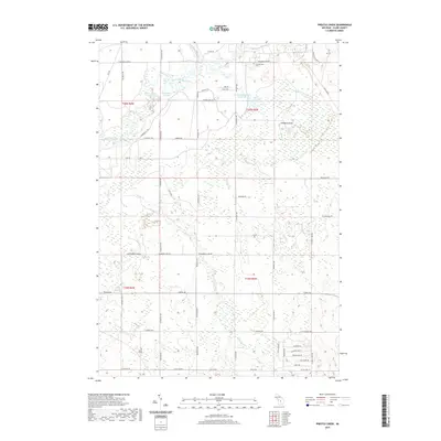
2019 Map of Prestle Creek
USGS Topo · Published 2019About this map
Muskegon River winds through the northwestern corner of this Clare County landscape, creating a complex network of backwaters such as Black Louies Bayou and Harrington Bayou. The northern reaches are defined by a significant wetland system where the Floodwood Swamp Reservoir and the broader Floodwood Swamp dominate the drainage patterns of Floodwood Creek. This area illustrates the classic interior Michigan terrain of low-lying marshes punctuated by modest elevations like McWatty Knoll.
Find a feature on this map
58 named features on this map. Tap any name to fly to it.
Don’t see what you’re looking for? This feature index may not catch every label — zoom into the map to look around manually.
Map Details
Editions of this 2019 Prestle Creek Map
This is the sole edition of this map. No revisions or reprints were ever made.
Other maps of this area

1954 · Traverse City
USGS Topo · 1:250,000

1954 · Midland
USGS Topo · 1:250,000

1957 · Harrison
USGS Topo · 1:62,500

1957 · Marion
USGS Topo · 1:62,500

1958 · Traverse City
USGS Topo · 1:250,000

1958 · Midland
USGS Topo · 1:250,000

1959 · Midland
USGS Topo · 1:250,000

1959 · Lake
USGS Topo · 1:62,500

1959 · Clare
USGS Topo · 1:62,500

1966 · Midland
USGS Topo · 1:250,000
Featured Places
- Redding Township, MI
- Winterfield Township, MI
- Greenwood Township, MI
- Summerfield Township, MI
- Clare County, MI