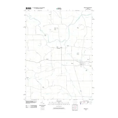
2010 Map of Preston
USGS Topo · Published 2010About this map
Preston serves as the primary hub in this eastern Iowa landscape, where the town grid is defined by the Preston Post Office and the crossing of state routes. The surrounding Jackson County countryside is intricately divided by a network of waterways including Copper Creek, Sugar Creek, and the meandering Maquoketa River to the north. For genealogists, the map is remarkably dense with family-named burial grounds and historic sites, ranging from the North Bend School Cemetery to various farm-based plots like the Schmidt Farm Cemetery and Russell Farm Cemetery. Small settlements like Spragueville and Higgensport anchor the rural sections, connected by a patchwork of gravel and paved roads such as Iron Bridge Rd. The southern portion of the quadrangle transitions into agricultural sections drained by Bear Creek and Simmons Creek, preserving a clear picture of the region's land use and local heritage at the start of the 21st century.
Find a feature on this map
39 named features on this map. Tap any name to fly to it.
Don’t see what you’re looking for? This feature index may not catch every label — zoom into the map to look around manually.
Map Details
Editions of this 2010 Preston Map
This is the sole edition of this map. No revisions or reprints were ever made.
Other maps of this area

1891 · DeWitt
USGS Topo · 1:62,500

1891 · Maquoketa
USGS Topo · 1:62,500

1892 · Goose Lake
USGS Topo · 1:62,500

1894 · Goose Lake
USGS Topo · 1:62,500

1899 · Clinton
USGS Topo · 1:125,000

1901 · Peosta
USGS Topo · 1:125,000

1901 · Rock Island
USGS Topo · 1:125,000

1910 · Rock Island
USGS Topo · 1:125,000

1935 · Miles
USGS Topo · 1:62,500

1941 · Miles
USGS Topo · 1:62,500