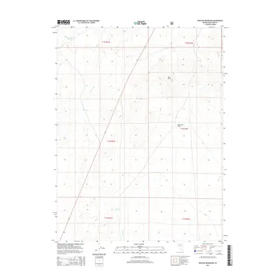
2014 Map of Preston Reservoir
USGS Topo · Published 2014About this map
The White River Valley defines the landscape of this high-desert basin, where drainage patterns and water management are the primary markers of human presence. In the southern reach, the Preston Reservoir sits as a vital water source, while further north the Giroux Wash Reservoir provides another point of surface water accumulation. The terrain is marked by seasonal and ephemeral watercourses including Giroux Wash, Jakes Wash, and Holt Cr, which channel runoff from the surrounding uplands toward the valley floor. Dark Peak rises as a prominent landmark in the northeast, overlooking the intersection of these drainages. This survey captures the arid character of eastern Nevada, highlighting the essential role of localized reservoirs and creek systems in a region defined by its hydrography and high-altitude valleys.
Find a feature on this map
14 named features on this map. Tap any name to fly to it.
Don’t see what you’re looking for? This feature index may not catch every label — zoom into the map to look around manually.
Map Details
Editions of this 2014 Preston Reservoir Map
This is the sole edition of this map. No revisions or reprints were ever made.
Other maps of this area

1952 · Ely
USGS Topo · 1:125,000

1956 · Lund
USGS Topo · 1:250,000

1956 · Ely
USGS Topo · 1:250,000

1958 · Ely
USGS Topo · 1:62,500

1958 · Giroux Wash
USGS Topo · 1:24,000

1958 · Ely
USGS Topo · 1:24,000

1959 · Ely
USGS Topo · 1:250,000

1959 · Preston Reservoir
USGS Topo · 1:62,500

1960 · Lund
USGS Topo · 1:250,000

1963 · Ely
USGS Topo · 1:250,000