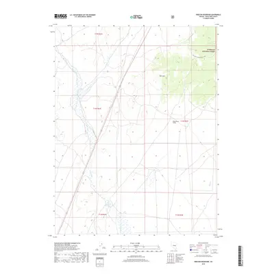
2018 Map of Preston Reservoir
USGS Topo · Published 2018About this map
White River Valley defines the landscape of this Nevada survey, showing a complex drainage network where Jakes Wash and Giroux Wash converge. In the southern portion of the quadrangle, the Preston Reservoir serves as a critical point of water management for the arid terrain. To the northeast, the land rises toward the high ground of the Humboldt National Forest, where Dark Peak stands as a prominent landmark. This 2018 U.S. Geological Survey record captures the intersection of natural watercourses like Holt Cr and Rowe Cr with modern infrastructure, including Natl Forest Develop Road 617 Rd, illustrating the transition from the valley floor to the protected forest uplands.
Find a feature on this map
14 named features on this map. Tap any name to fly to it.
Don’t see what you’re looking for? This feature index may not catch every label — zoom into the map to look around manually.
Map Details
Editions of this 2018 Preston Reservoir Map
This is the sole edition of this map. No revisions or reprints were ever made.
Other maps of this area

1952 · Ely
USGS Topo · 1:125,000

1956 · Lund
USGS Topo · 1:250,000

1956 · Ely
USGS Topo · 1:250,000

1958 · Ely
USGS Topo · 1:62,500

1958 · Giroux Wash
USGS Topo · 1:24,000

1958 · Ely
USGS Topo · 1:24,000

1959 · Ely
USGS Topo · 1:250,000

1959 · Preston Reservoir
USGS Topo · 1:62,500

1960 · Lund
USGS Topo · 1:250,000

1963 · Ely
USGS Topo · 1:250,000