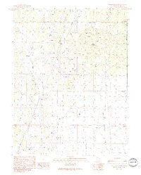
1990 Map of Preston Reservoir
USGS Topo · Published 1991About this map
White River Valley defines the landscape of this 1990 survey, where the arid plains of White Pine County meet the rising elevations of the Humboldt Nat For. The map centers on the Preston Reservoir, a vital water resource for the region, fed by the seasonal drainages of Jakes Wash and Giroux Wash. This area represents a classic Great Basin environment where ranching and resource extraction are primary activities, evidenced by several scattered Drill Hole sites and a Gravel Pit near the wash beds. At higher elevations, Dark Peak overlooks the valley floor, while infrastructure such as the Preston Seeding Windmill and Jakes Wash Well highlight the ongoing efforts to manage this dry terrain. The map also records early mining activity through various Prospect labels and a network of unimproved roads and transmission lines crossing the valley.
Find a feature on this map
16 named features on this map. Tap any name to fly to it.
Don’t see what you’re looking for? This feature index may not catch every label — zoom into the map to look around manually.
Map Details
Editions of this 1990 Preston Reservoir Map
This is the sole edition of this map. No revisions or reprints were ever made.
Other maps of this area

1952 · Ely
USGS Topo · 1:125,000

1956 · Lund
USGS Topo · 1:250,000

1956 · Ely
USGS Topo · 1:250,000

1958 · Ely
USGS Topo · 1:62,500

1958 · Giroux Wash
USGS Topo · 1:24,000

1958 · Ely
USGS Topo · 1:24,000

1959 · Ely
USGS Topo · 1:250,000

1959 · Preston Reservoir
USGS Topo · 1:62,500

1960 · Lund
USGS Topo · 1:250,000

1963 · Ely
USGS Topo · 1:250,000