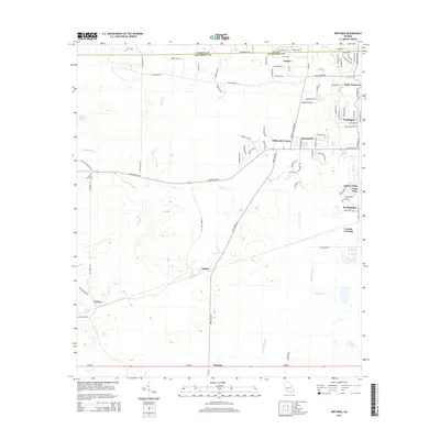
2014 Map of Pretoria
USGS Topo · Published 2014About this map
Pretoria and the rural lands west of Albany are defined by a complex network of waterways, where the drainage of Cooleewahee Cr and Tallahassee Cr shapes the landscape. In the northern reaches, suburban developments such as Gillionville Forest, Doublegate, and Saint Andrews show the residential growth pushing into former agricultural zones. These modern neighborhoods stand in contrast to the established railroad and road crossings like Walker, Ducker, and Lockett Crossing that historically anchored the region's movement. Local history and genealogy interests are grounded at the Mossy Grove Cem near the western edge of the quadrangle. The terrain is dotted with significant water features like Cedar Lake and Horse Lot Pond, illustrating the hydrology of this South Georgia corridor between the borders of Terrell, Lee, and Dougherty Counties.
Find a feature on this map
85 named features on this map. Tap any name to fly to it.
Don’t see what you’re looking for? This feature index may not catch every label — zoom into the map to look around manually.
Map Details
Editions of this 2014 Pretoria Map
This is the sole edition of this map. No revisions or reprints were ever made.
Other maps of this area

1953 · Dothan
USGS Topo · 1:250,000

1954 · Dothan
USGS Topo · 1:250,000

1955 · Dothan
USGS Topo · 1:250,000

1956 · Albany West
USGS Topo · 1:24,000

1956 · Baconton
USGS Topo · 1:62,500

1956 · Newton
USGS Topo · 1:62,500

1956 · Sasser
USGS Topo · 1:62,500

1956 · Albany
USGS Topo · 1:62,500

1973 · Chickasawhatchee
USGS Topo · 1:24,000

1973 · Sasser
USGS Topo · 1:24,000