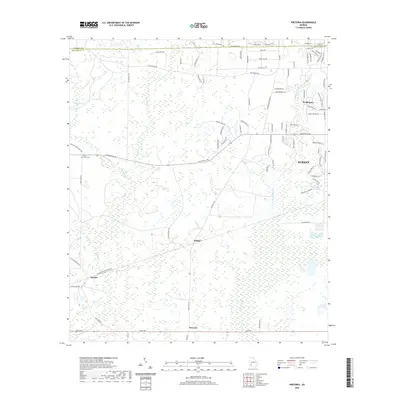
2020 Map of Pretoria
USGS Topo · Published 2020About this map
Pretoria and the surrounding Dougherty County landscape are defined by a complex network of wetlands and creeks, including the winding Cooleewahee Cr and Tallahasse Cr. This 2020 survey reveals the contrast between the western edges of Albany and the rural agricultural areas to the west. Small settlements like Ducker and Walker are situated along regional transport corridors, while residential developments such as Doublegate expand from the city center. The map's detailed hydrography, featuring names like Horse Lot Pond and Yancey Pond, highlights the region's low-lying terrain and drainage patterns. Genealogists and local historians can locate the Mossy Grove Cem near Gillionville Rd, a site of local significance in this portion of Southwest Georgia. The southern boundary is traced by Kiokee Cr, marking the transition toward more open rural lands.
Find a feature on this map
89 named features on this map. Tap any name to fly to it.
Don’t see what you’re looking for? This feature index may not catch every label — zoom into the map to look around manually.
Map Details
Editions of this 2020 Pretoria Map
This is the sole edition of this map. No revisions or reprints were ever made.
Other maps of this area

1953 · Dothan
USGS Topo · 1:250,000

1954 · Dothan
USGS Topo · 1:250,000

1955 · Dothan
USGS Topo · 1:250,000

1956 · Albany West
USGS Topo · 1:24,000

1956 · Baconton
USGS Topo · 1:62,500

1956 · Newton
USGS Topo · 1:62,500

1956 · Sasser
USGS Topo · 1:62,500

1956 · Albany
USGS Topo · 1:62,500

1973 · Chickasawhatchee
USGS Topo · 1:24,000

1973 · Sasser
USGS Topo · 1:24,000