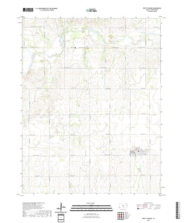
2022 Map of Pretty Prairie
USGS Topo · Published 2022About this map
Pretty Prairie anchors the southeastern portion of this South Central Kansas landscape, where a grid of section-line roads like Centennial Rd and Riverton Rd define the agricultural geography. The town's local street network, including Christy St, Main St, and E Booth St, centers on a compact residential and commercial core before giving way to the surrounding plains. To the north, the North Fork Ninnescah River meanders across the territory, joined by the smaller Irish Cr drainage. This 2022 survey records the enduring layout of rural Reno County, where family history and local land use are marked by sites such as Baker Cem along Pleasant Valley Rd. The map illustrates a highly organized prairie landscape where transportation routes like Pretty Prairie Rd and Silver Lake Rd connect isolated farmsteads and agricultural plots.
Find a feature on this map
29 named features on this map. Tap any name to fly to it.
Don’t see what you’re looking for? This feature index may not catch every label — zoom into the map to look around manually.
Map Details
Editions of this 2022 Pretty Prairie Map
This is the sole edition of this map. No revisions or reprints were ever made.
Other maps of this area

1889 · Cheney
USGS Topo · 1:125,000

1891 · Cheney
USGS Topo · 1:125,000

1892 · Kingman
USGS Topo · 1:125,000

1894 · Kingman
USGS Topo · 1:125,000

1901 · Cheney
USGS Topo · 1:125,000

1955 · Wichita
USGS Topo · 1:250,000

1955 · Pratt
USGS Topo · 1:250,000

1958 · Wichita
USGS Topo · 1:250,000

1959 · Pratt
USGS Topo · 1:250,000
1961 · Elmer
USGS Topo · 1:24,000