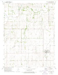
1971 Map of Pretty Prairie
USGS Topo · Published 1974About this map
Pretty Prairie serves as the primary hub of this Reno County landscape, where the Atchison Topeka and Santa Fe railroad corridor defines the town's western edge. The surrounding terrain is a mosaic of agricultural fields and watercourses, most notably the winding path of the North Fork Ninnescah River and its tributary, Irish Creek. A significant historical demarcation, the Old Indian Treaty Boundary, cuts across the southern section of the quadrangle, reflecting the early surveying and land division of the Kansas plains.
Find a feature on this map
12 named features on this map. Tap any name to fly to it.
Don’t see what you’re looking for? This feature index may not catch every label — zoom into the map to look around manually.
Map Details
Editions of this 1971 Pretty Prairie Map
This is the sole edition of this map. No revisions or reprints were ever made.
Other maps of this area

1889 · Cheney
USGS Topo · 1:125,000

1891 · Cheney
USGS Topo · 1:125,000

1892 · Kingman
USGS Topo · 1:125,000

1894 · Kingman
USGS Topo · 1:125,000

1901 · Cheney
USGS Topo · 1:125,000

1955 · Wichita
USGS Topo · 1:250,000

1955 · Pratt
USGS Topo · 1:250,000

1958 · Wichita
USGS Topo · 1:250,000

1959 · Pratt
USGS Topo · 1:250,000
1961 · Elmer
USGS Topo · 1:24,000