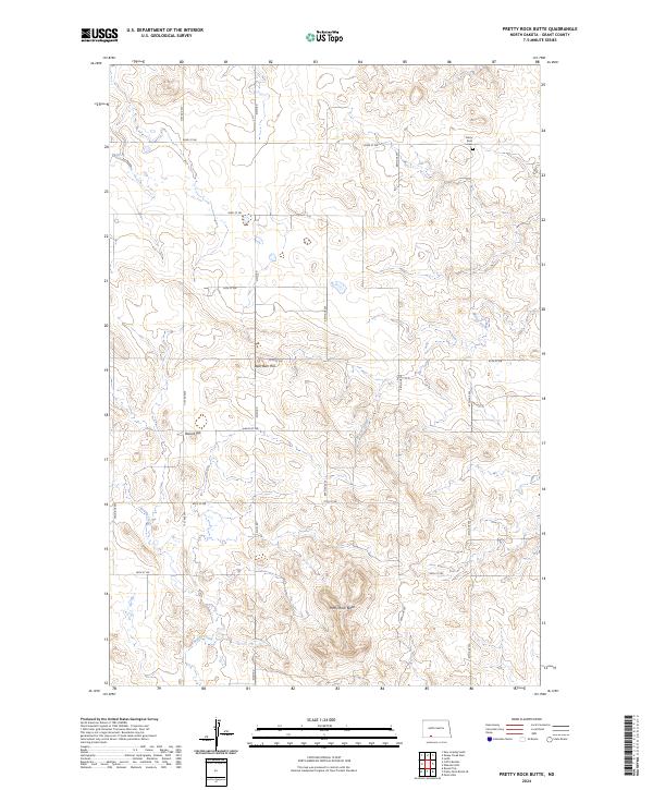
2024 Map of Pretty Rock Butte
USGS Topo · Published 2024About this map
Pretty Rock Butte and other high-elevation points like Round Top and the curiously named Beer Bum Hill dominate this portion of Grant County. The landscape is defined by the drainage patterns of Morris Creek and Brushy Creek, which carve through the undulating prairie. The area follows a strict section-line grid, with local travel dictated by corridors like Elgin Rd and various numerical avenues and streets. A key site for local history is the Pretty Rock Cem, located in the northeast near the border of t132n r89w. This layout reflects the enduring rural character of North Dakota's ranching and farming country, where high points served as vital navigation landmarks before the establishment of the modern road network.
Find a feature on this map
21 named features on this map. Tap any name to fly to it.
Don’t see what you’re looking for? This feature index may not catch every label — zoom into the map to look around manually.
Map Details
Editions of this 2024 Pretty Rock Butte Map
This is the sole edition of this map. No revisions or reprints were ever made.
Other maps of this area

1954 · Bismarck
USGS Topo · 1:250,000

1958 · Bismarck
USGS Topo · 1:250,000

1972 · Leith
USGS Topo · 1:24,000

1972 · Wheeler Hills
USGS Topo · 1:24,000

1972 · Coffin Buttes
USGS Topo · 1:24,000

1972 · New Leipzig South
USGS Topo · 1:24,000

1972 · Pretty Rock Butte
USGS Topo · 1:24,000

1972 · Sheep Creek Dam
USGS Topo · 1:24,000

1972 · Pretty Rock Butte SE
USGS Topo · 1:24,000

1972 · Round Top
USGS Topo · 1:24,000