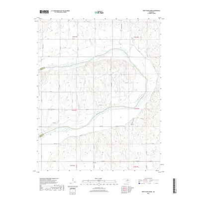
2018 Map of Prettyhair Creek
USGS Topo · Published 2018About this map
The Arkansas River carves a sweeping path through this northern Oklahoma landscape, defining the boundary between Osage and Noble counties. The terrain is marked by a complex network of tributaries, including Prettyhair Cr and Little Drum Cr, which drain into the river's winding channel. In the southeastern portion of the map, the river creates a massive U-shaped loop known as Big Bend, a prominent geographical feature that dominates the local topography.
Find a feature on this map
48 named features on this map. Tap any name to fly to it.
Don’t see what you’re looking for? This feature index may not catch every label — zoom into the map to look around manually.
Map Details
Editions of this 2018 Prettyhair Creek Map
This is the sole edition of this map. No revisions or reprints were ever made.
Other maps of this area

1930 · Pawnee
USGS Topo · 1:62,500

1936 · Belford
USGS Topo · 1:62,500

1936 · Pawnee
USGS Topo · 1:62,500

1955 · Enid
USGS Topo · 1:250,000

1958 · Enid
USGS Topo · 1:250,000

1963 · Charley Creek
USGS Topo · 1:24,000

1964 · Charley Creek NE
USGS Topo · 1:24,000

1968 · Ponca City SE
USGS Topo · 1:24,000
1968 · Ponca City
USGS Topo · 1:24,000

1972 · Morrison NE
USGS Topo · 1:24,000