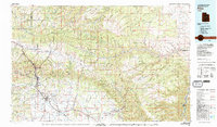
1980 Map of Price
USGS Topo · Published 1991About this map
Price River drainage patterns define this industrial corridor of eastern Utah, where the coal mining economy of the mid-20th century is etched into the landscape. The map details the dense cluster of mining camps and company towns that powered the region, from Kenilworth and Standardville to the sprawling Sunnyside area. Transportation networks are dominated by the Denver and Rio Grande Western RR and the Utah Railway, which thread through Price Canyon to service local operations like Castle Gate Mine No 3 and Columbia Mine. North and east of the valley, the terrain rises sharply into the striking geological formations of the Book Cliffs, Roan Cliffs, and the West Tavaputs Plateau. This survey captures the transition from the concentrated urban activity in Price and Helper to the expansive, high-altitude reaches of the Ashley National Forest and the Uinta Reservation.
Find a feature on this map
102 named features on this map. Tap any name to fly to it.
Don’t see what you’re looking for? This feature index may not catch every label — zoom into the map to look around manually.
Map Details
Editions of this 1980 Price Map
3 editions found
Other maps of this area

1885 · Salt Lake
USGS Topo · 1:250,000

1885 · Manti
USGS Topo · 1:250,000

1885 · East Tavaputs
USGS Topo · 1:250,000

1885 · Ashley
USGS Topo · 1:250,000

1885 · Uinta
USGS Topo · 1:250,000

1886 · Price River
USGS Topo · 1:250,000

1895 · Manti
USGS Topo · 1:250,000

1896 · Price River
USGS Topo · 1:250,000

1907 · Strawberry Valley
USGS Topo · 1:125,000

1909 · Strawberry Valley
USGS Topo · 1:125,000