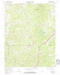
1964 Map of Price
USGS Topo · Published 1985About this map
The Virginia-North Carolina border bisects this 1964 survey, capturing a landscape defined by the upper reaches of the North Mayo River and South Mayo River. The southern portion in Madison, North Carolina, centers on the small community of Price, where the Norfolk and Western railroad corridor runs parallel to the highway. This era shows a distributed rural settlement pattern anchored by numerous country houses of worship, such as Christian View Ch and Mathews Chapel. To the north in Henry County, Virginia, the topography rises toward Chestnut Knob, which overlooks the Marrowbone Reservoir and the Prison Camp. The map documents a transition from the river bottomlands, including Buffalo Creek and Matrimony Creek, to the higher ridges and peaks like Holt Mtn.
Find a feature on this map
41 named features on this map. Tap any name to fly to it.
Don’t see what you’re looking for? This feature index may not catch every label — zoom into the map to look around manually.
Map Details
Editions of this 1964 Price Map
2 editions found
Other maps of this area

1924 · Martinsville
USGS Topo · 1:48,000

1926 · Martinsville
USGS Topo · 1:62,500

1926 · Critz
USGS Topo · 1:48,000

1927 · Martinsville
USGS Topo · 1:62,500

1928 · Critz
USGS Topo · 1:62,500

1944 · Martinsville
USGS Topo · 1:62,500

1953 · Winston-Salem
USGS Topo · 1:250,000

1953 · Greensboro
USGS Topo · 1:250,000

1954 · Greensboro
USGS Topo · 1:250,000

1955 · Winston-Salem
USGS Topo · 1:250,000