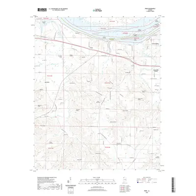
2020 Map of Pride
USGS Topo · Published 2020About this map
Pickwick Lake and the Tennessee River define the northern reaches of this landscape, where the Lauderdale Co / Colbert Co line follows the water's edge. The terrain transitions from the river's Pride Bluff and numerous towheads like Gibson Towhead into a series of ridges and hollows, including Hawk Pride Mtn and Red Rock Ridge. This area shows a pattern of small settlements and family burial grounds such as Basden Cem, Sherrod Cem, and Keeton Cem, often positioned near established thoroughfares like the Old Memphis Pike. The proximity of Tuscumbia on the eastern edge highlights the regional importance of this stretch of river for transportation and local commerce, while the interior is marked by named hollows such as Counterfeit Hollow and Willis Hollow.
Find a feature on this map
111 named features on this map. Tap any name to fly to it.
Don’t see what you’re looking for? This feature index may not catch every label — zoom into the map to look around manually.
Map Details
Editions of this 2020 Pride Map
This is the sole edition of this map. No revisions or reprints were ever made.
Other maps of this area

1914 · Muscle Shoals
USGS Topo · 1:48,000

1916 · Muscle Shoals
USGS Topo · 1:62,500

1924 · Tuscumbia
USGS Topo · 1:48,000

1924 · Gravelly Springs
USGS Topo · 1:48,000

1925 · Barton
USGS Topo · 1:62,500

1926 · Tuscumbia
USGS Topo · 1:62,500

1926 · Barton
USGS Topo · 1:48,000

1926 · Gravelly Springs
USGS Topo · 1:62,500

1929 · Barton
USGS Topo · 1:62,500

1935 · Cherokee
USGS Topo · 1:24,000