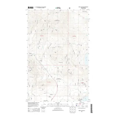
2013 Map of Priest Lake NW
USGS Topo · Published 2013About this map
Nordman sits at the southern reach of this mountain landscape, positioned along State Hwy 57 near the western shores of Priest Lake. The settlement serves as a gateway to the Kanisku National Forest, where a network of forest development roads provides access to high-elevation peaks and remote water bodies. The terrain is defined by the Selkirk Mountains, including notable summits like Blacktail Mtn, Nickelplate Mtn, and Granite Mtn.
Find a feature on this map
107 named features on this map. Tap any name to fly to it.
Don’t see what you’re looking for? This feature index may not catch every label — zoom into the map to look around manually.
Map Details
Editions of this 2013 Priest Lake NW Map
This is the sole edition of this map. No revisions or reprints were ever made.
Other maps of this area

1911 · Priest Lake
USGS Topo · 1:250,000

1913 · Priest Lake
USGS Topo · 1:250,000

1934 · Metaline
USGS Topo · 1:125,000

1942 · Metaline
USGS Topo · 1:125,000

1958 · Sandpoint
USGS Topo · 1:250,000

1963 · Sandpoint
USGS Topo · 1:250,000

1967 · Priest Lake SE
USGS Topo · 1:24,000

1967 · Priest Lake NE
USGS Topo · 1:24,000

1967 · Priest Lake NW
USGS Topo · 1:24,000

1967 · Helmer Mtn
USGS Topo · 1:24,000