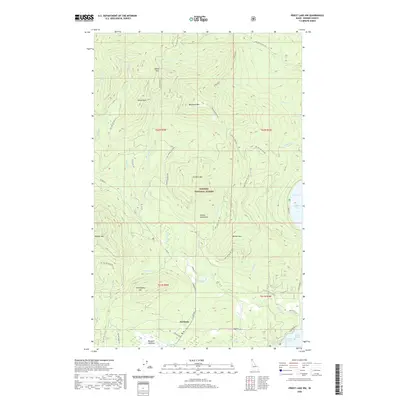
2020 Map of Priest Lake NW
USGS Topo · Published 2020About this map
Nordman serves as the primary settlement within the Kaniksu National Forest on this 2020 survey of northern Idaho. The landscape is defined by the high ridges of the Selkirk Mountains, featuring prominent peaks such as Nickelplate Mtn, Blacktail Mtn, and Watson Mtn. This high-altitude drainage system feeds several alpine water bodies, including Kerr Lake and Reeder Lake, which eventually descend toward the western shores of Priest Lake. The map reveals a complex network of forest development roads, such as Granite Creek Rd, which provide access to the timberlands and remote meadows like Bismark Meadows near the southern boundary. To the east, the shoreline of Priest Lake is punctuated by Distillery Bay and Reeder Bay, indicating the importance of the lakefront to the local geography and recreation economy of Bonner County.
Find a feature on this map
52 named features on this map. Tap any name to fly to it.
Don’t see what you’re looking for? This feature index may not catch every label — zoom into the map to look around manually.
Map Details
Editions of this 2020 Priest Lake NW Map
This is the sole edition of this map. No revisions or reprints were ever made.
Other maps of this area

1911 · Priest Lake
USGS Topo · 1:250,000

1913 · Priest Lake
USGS Topo · 1:250,000

1934 · Metaline
USGS Topo · 1:125,000

1942 · Metaline
USGS Topo · 1:125,000

1958 · Sandpoint
USGS Topo · 1:250,000

1963 · Sandpoint
USGS Topo · 1:250,000

1967 · Priest Lake SE
USGS Topo · 1:24,000

1967 · Priest Lake NE
USGS Topo · 1:24,000

1967 · Priest Lake NW
USGS Topo · 1:24,000

1967 · Helmer Mtn
USGS Topo · 1:24,000