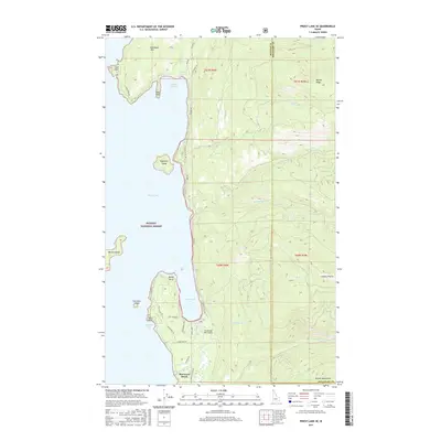
2017 Map of Priest Lake SE
USGS Topo · Published 2017About this map
Sherwood Beach sits along the southern eastern shore of Priest Lake, a region defined by its complex shoreline and the steep rises of the Selkirk Mountains. This 2017 study illustrates the recreational and residential development at the lake's edge, where roads like Eastshore Rd and Cavanaugh Bay Rd connect isolated points of interest. The area's topography is marked by significant elevations such as Roothaan Mtn and Horton Ridge, which overlook a series of islands including Eightmile Island and Bartoo Island.
Find a feature on this map
48 named features on this map. Tap any name to fly to it.
Don’t see what you’re looking for? This feature index may not catch every label — zoom into the map to look around manually.
Map Details
Editions of this 2017 Priest Lake SE Map
This is the sole edition of this map. No revisions or reprints were ever made.
Other maps of this area

1901 · Sandpoint
USGS Topo · 1:125,000

1911 · Priest Lake
USGS Topo · 1:250,000

1911 · Sandpoint
USGS Topo · 1:125,000

1913 · Priest Lake
USGS Topo · 1:250,000

1958 · Sandpoint
USGS Topo · 1:250,000

1963 · Sandpoint
USGS Topo · 1:250,000

1967 · Priest Lake SE
USGS Topo · 1:24,000

1967 · Coolin
USGS Topo · 1:24,000

1967 · Priest Lake NE
USGS Topo · 1:24,000

1967 · Priest Lake NW
USGS Topo · 1:24,000